System type: Porphyry gold
Target: Disseminated gold-copper
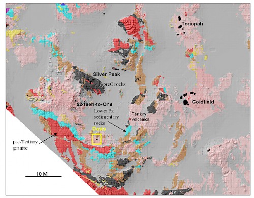
- Westcentral Nevada, 26 miles southwest of the Goldfield mining district (4 million ounces of gold produced)
- Unique porphyry gold system within the Walker Lane Province of western Nevada
- Widespread low-grade disseminated gold mineralization; surface gold to 6.3 g/t; the surface and subsurface gold zone system at +0.1 g/t is at least 1km by 1.25km but remains open
- System is centered on a multi-phase intrusive complex cutting Lower Paleozoic basement sedimentary rocks and overlying Tertiary andesitic volcanics which may be the same age as the host andesite in the Goldfield district; mineralization is hosted in all three units
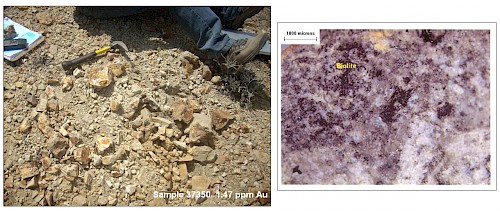
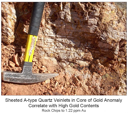
- Mineralization is coincident with potassic alteration, notably hydrothermal biotite-magnetite, and sheeted A-type quartz veinlets
- Gold correlates strongest with copper, molybdenum, tin and potassium
- Exposed and drilled portions of the system appear to represent the outer portions of a large porphyry Au-Cu system:
- Strong phyllic overprint to potassic alteration
- Surface and near-surface mineralization coincident with elevated Mo and Zn
- Increasing copper with depth
- Overlying barren advanced-argillic (silica-alunite) cap exposed
- Highlights of drilling completed in 2010 and 2011 by Centerra Gold (U.S.):
- Hole 14: 96.lm of 0.26 g/t including 12.2m of 0.40 g/t
- Hole 15: 7.6m of 0.80 g/t and 10.7m of 0.63 g/t
- Hole 10: 13.7m of 0.49 g/t including 3.0m of 1.06 g/t
- Hole 24: 169.2m of 0.22 g/t
- Hole 26: 30.5m of 0.40 g/t including 10.7m of 0.91 g/t
- Drilling results show copper increasing with depth accompanied by low-grade gold mineralization. However, the deepest drilling has tested to only 365m (1,200 feet) below surface, and 5 of the 11 holes drilled in 2011 failed to reach targeted depths.
- The gold system remains open at depth and to the south and west with potential for significant gold-copper mineralization below the previous drilling

Regional geologic map showing location of Oasis Project in west-central Nevada; black dots/areas are productive/significant gold-silver deposits.

Exposures of “soft”, mineralized, potassically-altered volcanic or intrusive rock, with photomicrograph of disseminated hydrothermal biotite typical of porphyry Au-Cu systems.

