System type: Carlin-type, sediment-hosted gold
Target: Disseminated mineralization
The Gold Cloud Project contains sediment-hosted (Carlin-type) gold mineralization along a range-front fault about 17 miles south of Barrick’s Ruby Hill gold mining operations in the Eureka Mining District. The Project lies along the southeastern part of the Cortez gold belt.
Gold Cloud contains an extensive area of carbonate veins and silicification (jasperoids) within Devonian limestone that is exposed for a strike length of 6,800 feet (2km) following a northeast-trending range-front fault. Anomalous gold (>0.1 ppm) and favorable trace elements are largely concentrated along a 2,500-foot long zone within quartz-veined jasperoids and hematitic carbonate veins. Gold reaches 2.80 ppm gold (0.082 opt) with strong favorable trace elements reaching 2.6 ppm Hg, 527 ppm Sb and 351 ppm As. A second area of anomalous gold in silicification occurs 2,700 feet to the northeast, where gold values in outcrop reach 0.611 ppm, also with strongly elevated As, Hg and Sb. Valley-fill sediments (pediment) beyond the range-front fault appear to be thin, based on relatively detailed gravity data as well as the occurrence of north-northwest-trending outcrops of limestone outboard of the range front. The project lies along the northeast side of a distinctive feature in the regional geophysical gravity data which coincides with the Cortez gold belt and extends north-northwest for least 70 miles from the Gold Cloud area through the Gold Bar and Tonkin Springs gold districts and the world-class Pipeline-Cortez Hills gold district.
During gold mineralization in these types of deposits, the limestones are dissolved or decalcified, and the calcium carbonate is then remobilized to overlying and peripheral areas. Therefore, the exposed carbonate vein system, the silicification and favorable geochemistry could be the uppermost or distal portion of a large Carlin-type gold system yet to be identified, either beneath the exposed veins or outboard of the range front under pediment cover. Rare native sulfur in the jasperoid also indicates a distal setting.
The next phase of exploration should include geophysics, to delineate structures and depth to basement in the pediment area; additional mapping and sampling, including identification (age and correlation) of the host formation in order to better understand and predict the stratigraphic section; and first-phase drilling.
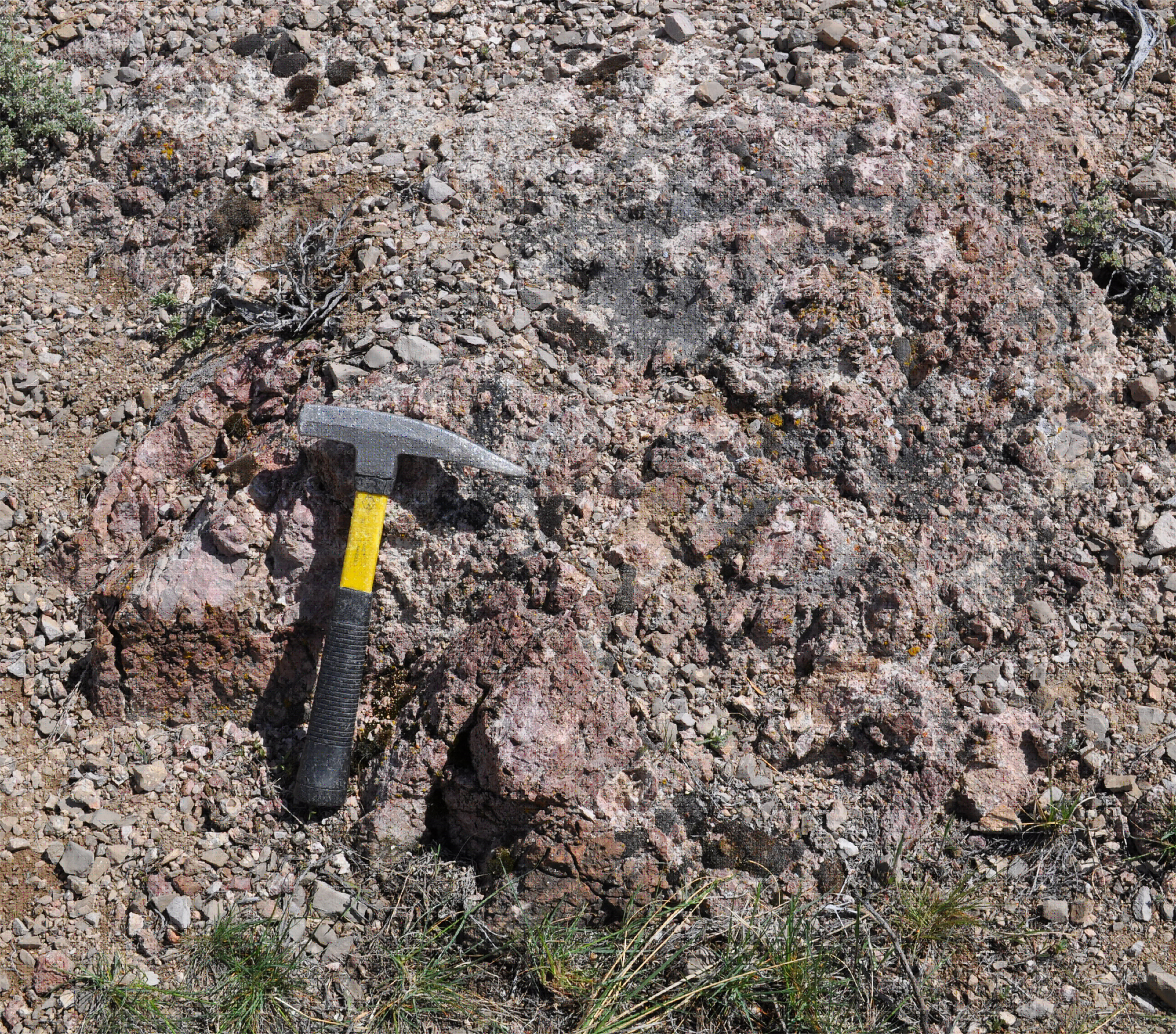
Reddish-brown jasperoid; 2.8 ppm gold, 91 ppm As, 2.1 ppm Hg, 88 ppm Sb
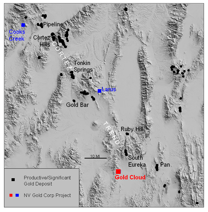
Location of the Gold Cloud Project